Most buyers who ask for LiDAR drone mapping don't actually need it. The ones who do would be foolish to skip it.
That's the whole decision in two sentences, and it's the part every spec-sheet guide leaves out. Search "LiDAR drone mapping" and you'll get sensor catalogs, point-density charts, and lists of the best payloads to buy. What you won't get is a straight answer to the question you actually have: is LiDAR worth the premium on my job, or is a provider upselling me? By the end of this piece you'll know the four situations where LiDAR earns its cost, the much larger set where photogrammetry does the same work for a third of the price, and what hiring either one runs.
The one difference that actually matters
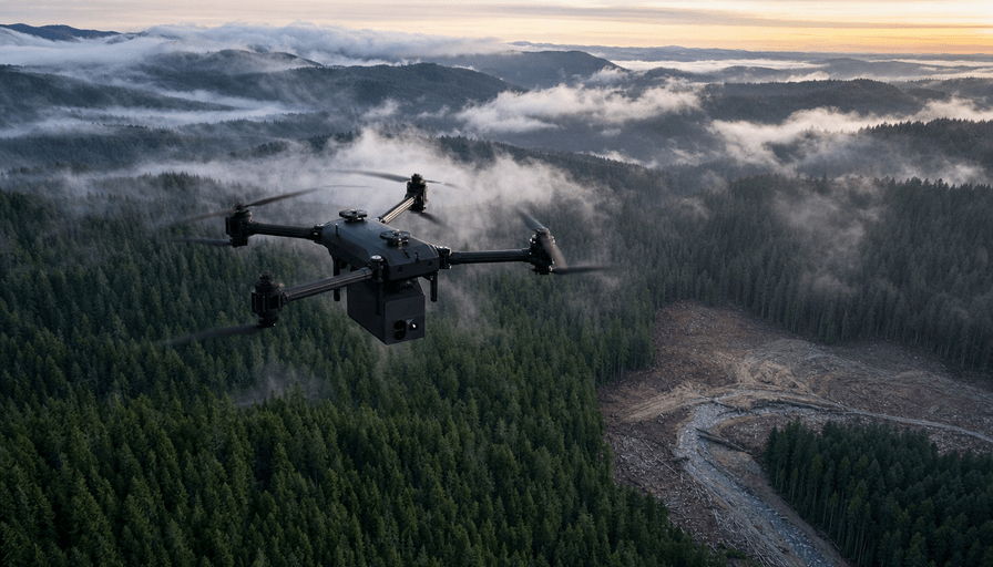
Strip away the jargon and LiDAR beats photogrammetry in exactly one way that matters to a buyer: it can see the ground through vegetation. A LiDAR sensor fires hundreds of thousands of laser pulses per second, and enough of them slip between leaves and branches to hit bare earth. Photogrammetry stitches together overlapping photos, so it can only map what the camera can see. Point a camera at a forest and you map the top of the canopy. Point LiDAR at the same forest and you get the terrain underneath.
That gap between the two outputs has names. Photogrammetry gives you a Digital Surface Model, the visible top layer. LiDAR gives you a Digital Terrain Model, the bare-earth ground surface, which is what a civil engineer or floodplain study actually needs. This is the core mechanic behind most drone mapping services, and it's why the two methods aren't really competitors so much as different tools.
The accuracy numbers are closer than the price gap suggests. In open, unobstructed ground, good photogrammetry with proper ground control hits roughly 1 to 3 cm horizontal accuracy, which rivals LiDAR. Where they split is point density and vegetation. LiDAR captures 50 to 200 points per square meter; photogrammetry lands around 5 to 20. On a bare parking lot that difference is academic. Under a tree canopy it's the difference between usable data and garbage.
When you genuinely need LiDAR
Here's the honest list. If your project is one of these, LiDAR isn't an upsell, it's the right call.
Vegetation and forestry. Any site with meaningful tree cover, brush, or tall crops where you need the actual ground elevation. Photogrammetry physically cannot deliver bare earth under canopy. This is the number-one legitimate reason to pay for LiDAR, and it's not close.
Corridor and powerline mapping. Thin objects like transmission lines, guy wires, and cell tower components are nearly invisible to photogrammetry, which needs an object to appear consistently across many photos to reconstruct it. LiDAR pulses catch individual wires cleanly. If you're mapping utilities, pipelines, rail, or roadway corridors, LiDAR is standard for a reason.
Precise bare-earth terrain models. Floodplain analysis, drainage design, cut-and-fill volumetrics on stockpiles, and anything feeding a hydrology or grading model. These need a clean DTM with tight vertical accuracy. If you're benchmarking against a survey specification, the USGS 3DEP quality levels are the reference: QL2 requires at least 2 points per square meter and QL1 at least 8, and a good drone LiDAR run clears both easily.
Low light and complex geometry. LiDAR is active, meaning it makes its own light, so it works at dusk or in shadow where photogrammetry starves for detail. Niche, but real for certain inspection and mining jobs.
Notice what's not on this list: pretty pictures. LiDAR point clouds are gray and geometric. If your deliverable is meant to look good to a human, that's a photogrammetry job.
When LiDAR is an expensive upsell
If your site is open ground and you can see the dirt from the air, you almost certainly don't need LiDAR. Photogrammetry will map it accurately, in full color, for a fraction of the cost. A few common cases where I'd push back on a LiDAR quote:
- Construction progress and site documentation. Open earthwork, stockpiles you can see, foundation and slab tracking. Photogrammetry handles this at a lower price and gives you a textured model the whole team can read. This is bread-and-butter drone surveying services territory.
- Real estate and property marketing. You want imagery, not a point cloud. LiDAR here is money lit on fire.
- Small open lots and topos under a few acres. With ground control points, photogrammetry hits survey-usable accuracy on clear terrain. The LiDAR premium buys you nothing.
- Visual 3D models and inspections where color matters. Roof condition, facade detail, marketing renders. Photogrammetry wins on realism.
The tell that you're being upsold: a provider recommends LiDAR for an open, treeless site without asking what your deliverable is. A good operator asks about vegetation and the intended output before quoting a sensor.
What LiDAR drone mapping costs
Two numbers matter: what it costs to hire, and why that number is what it is.
Hiring a drone LiDAR survey runs roughly $1,500 to $3,000 per day, or $10 to $150 per acre with the per-acre rate sliding down hard as the site grows. A 500-plus-acre corridor might land near the low end per acre; a small, detail-heavy job sits at the top. As a rule of thumb, expect LiDAR to cost about 2 to 3 times what the same area would run in photogrammetry, where per-acre rates at scale can drop toward a few dollars. If you want the full breakdown of how survey pricing is built, we cover it in what a full drone survey costs.
The premium traces straight back to the hardware. A photogrammetry rig is a camera drone in the $2,000 to $20,000 range. LiDAR payloads start higher and climb fast:
- DJI Zenmuse L2 on a Matrice 350 RTK, the current workhorse for commercial mapping, runs about $15,715 for the payload and delivers roughly 4 cm vertical accuracy at 150 m with RTK. It covers up to 2.5 square kilometers in a single flight.
- Mid-tier systems from the likes of Rock Robotic and Microdrones sit in the $30,000 to $50,000 range.
- Survey-grade sensors from YellowScan and RIEGL push past $100,000, and a full survey-grade setup can approach $350,000.
That spread is why LiDAR providers charge what they do, and why the right sensor for your job depends entirely on the accuracy you actually need. If you're weighing buying versus hiring, our guide to the best drones for surveying walks through the tradeoff. For most buyers running a one-off or seasonal project, hiring wins on math for a long time. And whichever way you go, the operator must hold a Part 107 certificate to fly commercially in US airspace.
FAQ
How much does a LiDAR drone survey cost?
Expect roughly $1,500 to $3,000 per day, or $10 to $150 per acre depending on site size and detail. Large corridors land near the low per-acre end; small, high-detail jobs sit at the top. Budget 2 to 3 times what an equivalent photogrammetry survey would cost.
Do I need LiDAR, or is photogrammetry good enough?
If your site is open ground you can see from the air, photogrammetry is almost always enough and much cheaper. Choose LiDAR when you need bare-earth elevation under vegetation, or when you're mapping thin objects like power lines. Everything else is usually a photogrammetry job.
Can a DJI drone do LiDAR mapping?
Yes. The DJI Zenmuse L2 mounts on the Matrice 350 RTK and is the most common commercial LiDAR setup in the US. They're the reason survey-grade LiDAR dropped from six figures toward the $15,000 range for the sensor.
How accurate is LiDAR drone mapping?
A DJI Zenmuse L2 delivers about 5 cm horizontal and 4 cm vertical accuracy at 150 m with RTK. Survey-grade RIEGL and YellowScan systems tighten that to a few centimeters or better. Real-world accuracy also depends on flight planning, ground control, and how the data is processed.
Does LiDAR really see through trees?
Not through solid canopy, but through the gaps. A LiDAR sensor fires enough pulses that some slip between leaves and branches to reach the ground, which is enough to reconstruct a bare-earth terrain model. Photogrammetry can't do this at all, which is the single biggest reason to pay for LiDAR.
The bottom line
LiDAR drone mapping is a precision tool, not a default setting. Match it to the obstruction, not the brochure: pay the premium when vegetation, thin wires, or a demanding bare-earth model actually require it, and let photogrammetry handle the open, visual, budget-conscious majority of jobs. The fastest way to know which camp your project falls in is to describe your site and your deliverable to a provider and watch whether they ask about tree cover before they quote you a sensor. Browse drone mapping providers on DroneServices or see drone pilots in Atlanta to get a couple of quotes and compare.