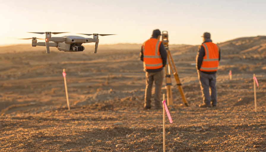
A drone survey can map a 40-acre site in a single morning, hand you a measurable orthomosaic and a topographic model by the next day, and cost a fraction of what a two-person ground crew charges to walk the same ground with a total station. That's the pitch, and for a lot of jobs it holds up.
Here's the part most guides skip. A drone deliverable with dimensions on it, contours, property lines, area calculations, can legally count as land surveying, and in most states only a licensed surveyor can sign off on that work. Flying under an FAA Part 107 certificate gets you permission to operate the aircraft commercially. It does not give you authority to survey. This guide covers where drone surveying genuinely beats a ground crew, where it legally can't replace a licensed surveyor, what accuracy you should expect, what it costs, and how to vet a provider before you write a check.
When drone surveying beats a ground crew
The clearest wins are large sites, hazardous sites, and anything you need measured more than once. A drone flies a grid overhead instead of a crew walking transects, so coverage scales with battery life, not headcount. A fixed-wing VTOL platform like the WingtraOne covers hundreds of acres in a single flight at mapping-grade accuracy, a job that would take a ground crew days.
Three use cases where drones win outright:
- Stockpile and earthwork volumes. Photogrammetry turns a pile of aggregate or a cut-and-fill site into a volume number in cubic yards, with far less labor than staking a grid by hand.
- Progress tracking. Monthly flights over an active build give you a dated, measurable record. That's the backbone of most construction drone services.
- Inaccessible or dangerous terrain. Steep slopes, active quarries, flooded ground, and contaminated sites are all safer to map from the air than on foot.
The deliverables are what you're actually buying: an orthomosaic (a stitched, scaled aerial map), a digital surface or terrain model, elevation contours, a 3D point cloud, volume calculations, and CAD/GIS-ready files your engineer can drop straight into design software. For the wider picture of how those outputs get produced across use cases, our drone mapping services guide is the pillar for this whole cluster.
When it can't replace a licensed land surveyor
This is the line that gets buyers in trouble. A boundary survey, a plat, a subdivision layout, an ALTA/NSPS survey, or anything that establishes a legal property line requires a licensed Professional Land Surveyor (PLS) to sign and seal it. A drone can't do that. Neither can a Part 107 pilot who isn't also a licensed surveyor.
This isn't hypothetical. In 360 Virtual Drone Services LLC v. Ritter (2024), the Fourth Circuit upheld North Carolina's authority to bar a drone operator from selling maps and 3D models with measurable data, on the grounds that producing "location and dimension data" and "orthomosaic maps, quantities, and topographic information" is the practice of land surveying and requires a state license. The operator held a Part 107 certificate. The court said that wasn't the point: Part 107 governs who can fly, and states govern who can survey.
What this means for you: if your deliverable has to hold up in a permit application, a property dispute, or a real estate closing, hire a licensed surveyor who uses drones as a tool. Plenty do. Many drone firms partner with a PLS who reviews and stamps the output. For internal-use maps, construction progress, stockpile volumes, inspection imagery, marketing, the licensing question usually doesn't apply, and a solid Part 107 operator is all you need.
Accuracy: what "survey-grade" actually means
Two numbers matter, and vendors love to blur them. Relative accuracy is how consistent measurements are within the map. Absolute accuracy is how well the map lines up with real-world coordinates on the ground. A map can be internally tight and still sit three feet off true position.
With professional hardware and proper ground control, a drone survey typically hits ±1-3 cm horizontal and ±2-5 cm vertical accuracy, per industry accuracy guidance. Getting there depends on two things:
- RTK or PPK positioning, which corrects the drone's GPS to centimeter level in flight or in post-processing. An RTK drone like the DJI Mavic 3 Enterprise can reduce or eliminate the need for physical ground control on most sites.
- Ground control points (GCPs), surveyed markers on the ground that anchor the map to true coordinates. Even on RTK jobs, good surveyors lay a few GCPs and hold some back as independent check points, because that's the only way to prove absolute accuracy to an auditor.
One more question decides your hardware: vegetation. Photogrammetry measures the top of whatever it can see, so it can't read bare earth under tree canopy. LiDAR can. A system like the DJI Zenmuse L2 fires roughly 240,000 points per second with multiple returns per pulse, punching through foliage to model the ground beneath. If your site is open dirt, photogrammetry is fine and cheaper. If it's wooded, you want LiDAR. Our best drones for surveying breakdown goes deeper on the hardware tradeoffs.
What drone surveying costs
For a typical small site (up to about 10 acres), expect $1,500 to $3,000 for a photogrammetry survey with standard deliverables: orthomosaic, surface model, contours. Ten to fifty acres runs roughly $3,000 to $10,000 depending on deliverables and turnaround. Many operators also quote a day rate of $1,500 to $3,000, which can pencil out cheaper on large jobs once the per-acre math takes over.
Per acre, photogrammetry commonly lands around $150 to $300 on smaller jobs and drops toward $15 to $50 per acre on large ones. LiDAR runs two to three times that, often $150 to $500 per acre, because the sensor is expensive and the point-cloud processing is heavier. The full drone surveying cost breakdown has the numbers by project type. Two line items buyers forget: ground control setup (that's labor on the ground) and licensed-surveyor review if you need a stamped deliverable.
How to hire a drone surveyor
Run any provider through this short checklist before you commit:
- Certification for the job. Part 107 is the floor for legal flight. If you need a stamped, legal survey, confirm a licensed PLS is signing the deliverable, not just the pilot.
- The right sensor. Photogrammetry for open ground, LiDAR for vegetation or bare-earth-under-canopy work. Don't pay the LiDAR premium if the site doesn't need it.
- Ground control and accuracy proof. Ask how they establish absolute accuracy and whether they'll share check-point residuals. "Centimeter-grade" with no ground control is a red flag.
- Sample deliverables. Ask to see an orthomosaic and a report from a comparable project, in the file formats your engineer actually uses.
- Insurance. Commercial UAV liability coverage at minimum. Larger sites and near-structure work may warrant more.
If you're comparing quotes locally, start with providers who already know your jurisdiction's rules. You can find drone surveyors near you or, if you're in Georgia, browse drone surveyors in Atlanta.
FAQ
Can a drone replace a licensed land surveyor?
Not for legal work. Boundary surveys, plats, and anything that establishes a property line still require a licensed Professional Land Surveyor to sign and seal it, and a Part 107 certificate doesn't grant that authority. For topographic maps, volumes, and progress documentation that aren't legal instruments, a drone flown by a good Part 107 pilot is often all you need.
How accurate is a drone survey?
With RTK or PPK positioning and proper ground control, expect roughly ±1-3 cm horizontally and ±2-5 cm vertically. Accuracy drops fast without ground control points, so ask any provider how they verify absolute accuracy, not just relative consistency within the map.
How much does a drone survey cost?
A small site (under 10 acres) typically runs $1,500 to $3,000 for photogrammetry with standard deliverables. Larger sites scale to $3,000 to $10,000 or more, and LiDAR adds two to three times the photogrammetry rate. Ground control and licensed-surveyor review are common add-ons.
Do I need LiDAR or is photogrammetry enough?
If your site is open ground, photogrammetry is accurate and cheaper. If you need bare-earth elevations under tree canopy or dense brush, you need LiDAR, because photogrammetry only measures the surface it can see. Match the sensor to the vegetation, not to the sales pitch.
What certification should a drone surveyor have?
At minimum, a current FAA Part 107 Remote Pilot Certificate. For any deliverable that needs to be legally defensible, confirm a licensed Professional Land Surveyor is reviewing and stamping the output, either in-house or through a partnership.
Drone surveying earns its keep on large, hazardous, or frequently-measured sites, and on any job where you need volumes, topography, or a dated visual record faster and cheaper than a ground crew can deliver. The one place it doesn't replace a person is the legal boundary survey, where a licensed surveyor's stamp is the entire point. Match the sensor to your terrain, insist on real accuracy proof, and confirm the licensing before the deliverable lands, not after.
Browse vetted drone service providers on DroneServices to compare surveyors in your area and get quotes on your project.