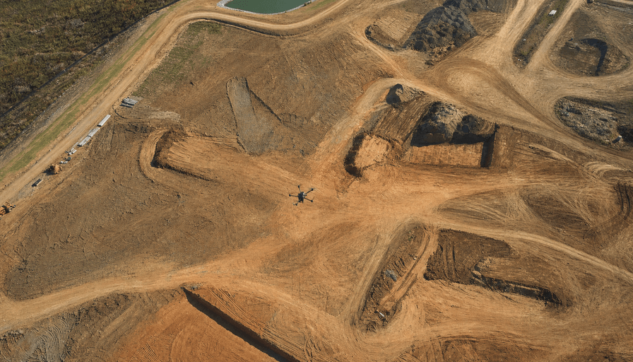
Most drone surveys in 2026 land between $1,500 and $10,000, and per acre the math usually runs $150 to $500 depending on whether you need photogrammetry or LiDAR. A five-acre topo can cost as little as $600 to $1,500. A 200-acre LiDAR corridor can push past $15,000. The spread is that wide because "a drone survey" covers everything from a quick orthomosaic to a stamped, survey-grade topographic dataset with centimeter accuracy.
This guide breaks down what drone surveying companies actually charge in 2026, per acre and per project, by job type. We'll put it next to a traditional ground crew and show you which line items push a quote up, so you can read one without guessing. If you're still deciding whether drone is the right tool at all, start with our overview of drone surveying services and come back for the numbers.
What a drone survey costs in 2026
Here's the fast answer, sorted by site size. These are typical US ranges for a standard photogrammetry survey with a basic deliverable, an orthomosaic plus contours, before add-ons:
- Under 5 acres: $600 to $1,500
- 5 to 20 acres: $1,000 to $2,000
- 20 to 50 acres: $1,500 to $2,500
- 50 to 200 acres: $2,000 to $3,500
- 200+ acres: custom quote, often $4,000 and up
Notice the curve flattens as acreage grows. A drone doesn't care much whether it's flying 10 acres or 40; flight time and processing scale slowly, so the per-acre cost drops fast on bigger jobs. That's the whole economic argument for aerial survey, and it's why the method wins hardest on large, open sites.
Two things move you off these baselines: the sensor (photogrammetry versus LiDAR) and the deliverable (a picture versus a stamped, survey-grade dataset). We'll take both in turn.
Per-acre pricing, and why the job type matters
Per acre, plan on roughly $150 to $300 for drone photogrammetry and $150 to $500 for LiDAR. Wide-open terrain with no tree cover can drop as low as $30 to $120 per acre, because the flight is simple and the processing is clean. Here's how the common job types actually price out.
Topographic survey. The bread-and-butter job. A 5-acre topo runs about $1,200 to $3,000; a 50-acre topo lands around $5,000 to $14,000. You're paying for contours, a digital terrain model, and CAD or GIS-ready files a designer can build on.
Construction progress mapping. Recurring flights over an active site, usually monthly. Individual flights come in cheaper because the pilot already has ground control set and a repeatable flight plan, so expect a per-visit rate rather than a one-off survey fee. This is where drone mapping services earn their keep, since the value is in the time series, not any single map.
Volumetrics and stockpiles. Measuring pile volumes for a quarry, landfill, or aggregate yard. The flight is quick, but the volumetric analysis is a paid deliverable on top of the base map, typically $300 to $600. A single pilot can reconcile a dozen stockpiles across 50 acres in two battery cycles and hand back per-pile volumes the same day, which is exactly why quarry operators moved to drone reconciliation.
LiDAR premium. LiDAR costs more because the sensor costs more and the data is heavier to process. A payload like the DJI Zenmuse L2 fires 240,000 points per second with up to five returns per pulse, which lets it punch through tree canopy to map the ground underneath. That canopy penetration is the one thing photogrammetry can't do, so if your site is wooded, LiDAR isn't an upsell, it's the requirement. For bare dirt it usually is overkill, and photogrammetry gets you the same contours for less. Our LiDAR drone mapping breakdown covers when the premium is worth paying.
Drone vs a traditional ground survey crew
This is the comparison most buyers are really running, and on anything over about five acres the drone wins on both price and time. A two-person ground crew bills by the day and walks the site point by point. Aerial capture collects millions of points in a single flight.
The numbers, for a topographic survey:
- 5 acres: ground $3,000 to $8,000, drone $1,200 to $3,000
- 20 acres: ground $15,000 to $30,000, drone $3,000 to $6,000
- 50 acres: ground $15,000 to $40,000, drone $5,000 to $14,000
Savings typically run 40 to 70 percent, and the time gap is even bigger. A 40-acre commercial site that eats three to four weeks of field time for a ground crew can be flown in one to two days, with the deliverable back inside a week. On a small, tight urban lot with heavy tree cover the math flips, and a traditional crew can be both cheaper and more accurate. Drone economics need open space and area to shine.
What drives a drone surveying quote up
Two jobs that sound identical can quote thousands apart. Here's what's usually behind the gap.
Accuracy and ground control. Survey-grade accuracy comes from either RTK/PPK positioning onboard the drone or ground control points (GCPs) surveyed into the site, and often both. RTK gear on drones like the DJI Matrice 4E or Mavic 3 Enterprise RTK delivers centimeter accuracy without laying dozens of targets, but a job that demands legally defensible accuracy still gets GCPs, and that's more field time on the invoice.
The deliverable format. An orthomosaic image is cheap. A point cloud, a 3D surface model, contour lines, and CAD/GIS files each add processing and cost. Add-ons stack fast: a 3D model runs $200 to $500, a point cloud $300 to $500, volumetric analysis $300 to $600. Be specific about what you actually need, because paying for a point cloud you'll never open is the most common way buyers overspend.
The licensed-surveyor stamp. This is the big one, and it's where "drone surveying companies" and "land surveyors" quietly diverge. A Part 107 pilot can legally fly and collect data, but in most states a topographic or boundary survey used for legal, engineering, or payment purposes has to be certified by a licensed Professional Land Surveyor (PLS). The FAA governs who can fly commercially; your state licensing board governs who can stamp the result. A stamped deliverable costs more because a licensed surveyor's liability rides on it. If a vendor quotes you a rock-bottom price, ask whether the output will be stamped, because an unstamped map isn't a survey your engineer or the county can use.
Site conditions do the rest: dense vegetation, steep terrain, controlled airspace near an airport that needs authorization, and a rushed turnaround all push the number up.
How to price your own project
Start with your acreage and your real deliverable. If you need contours and CAD files to design on an open 30-acre site, you're in photogrammetry territory, probably $1,800 to $2,800, no LiDAR needed. If it's wooded or you need a stamped survey, budget higher and confirm a PLS is in the loop. Get two or three quotes, since regional pricing varies: a drone surveying company in Houston or Denver often quotes differently than one in a rural county with less competition. You can find providers by area through drone surveying companies near you, then match each quote against the checklist above.
Frequently asked questions
How much does a drone survey cost per acre in 2026?
Photogrammetry runs about $150 to $300 per acre and LiDAR $150 to $500 per acre. Open, treeless terrain can drop to $30 to $120 per acre. Small sites carry a minimum fee, so under five acres you'll usually pay a flat $600 to $1,500 rather than a true per-acre rate.
Is a drone survey cheaper than a traditional land survey?
On sites over about five acres, yes, usually 40 to 70 percent cheaper and far faster. A 50-acre topo might run $5,000 to $14,000 by drone versus $15,000 to $40,000 by ground crew. On small or heavily wooded lots, a traditional crew can still be cheaper and more accurate.
Do I need a licensed surveyor, or is a drone pilot enough?
It depends on the deliverable. A Part 107 pilot can legally collect the data, but most states require a licensed Professional Land Surveyor to certify (stamp) topographic, boundary, or volumetric surveys used for legal or payment purposes. Ask any vendor whether the final deliverable will be stamped.
Does LiDAR always cost more than photogrammetry?
Almost always, because the sensor and the processing are more expensive. LiDAR is worth the premium when you're mapping under tree canopy or need the highest vertical accuracy. For bare, open ground, photogrammetry usually delivers the same contours for less.
What makes one drone survey quote higher than another?
Accuracy requirements (RTK and ground control), the deliverable format (a point cloud and CAD files cost more than a flat image), whether a licensed surveyor stamps the result, and site conditions like vegetation, terrain, and airspace.
The bottom line
Budget $1,500 to $10,000 for most drone surveys in 2026, lean on the per-acre ranges ($150 to $500) to sanity-check a quote, and let the job type set your expectations: bare-ground topo is cheap, wooded LiDAR and stamped survey-grade work cost more. The single question that separates a fair quote from a bad one is whether the deliverable is stamped by a licensed surveyor, so ask it early. Browse the drone surveying companies listed on DroneServices to compare providers and get quotes matched to your site.