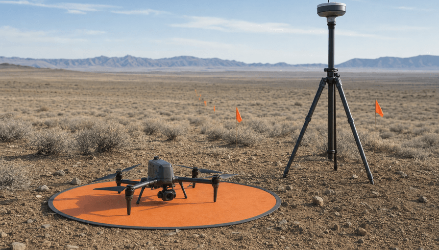
The best drone for surveying isn't the one with the sharpest camera. It's the one whose positioning system and flight time match the size of the jobs you actually fly, and for most US firms in 2026 that is not a $30,000 LiDAR rig.
Here's what you'll get in the next few minutes: which drone fits your project size and budget, what "survey grade" really requires (hint, it's the GPS, not the megapixels), when a LiDAR sensor earns its keep, and the moment where buying stops making sense and you should just hire a pilot instead. We run a directory of survey and mapping pilots, so we spend a lot of time watching firms buy the wrong tier of gear. This is the guide we wish they'd read first.
What makes a drone "survey grade" (RTK/PPK, not megapixels)
A survey-grade drone is defined by how it knows where each photo was taken, not by resolution. That comes down to two acronyms: RTK and PPK.
RTK (Real-Time Kinematic) corrects the drone's position in the air against a base station or a correction network, tagging each image to roughly 1 cm plus 1 ppm. PPK (Post-Processed Kinematic) logs the raw satellite data and does the same correction on your laptop after landing. The accuracy is equivalent. PPK is the more forgiving of the two when your radio link is spotty or you're flying a big site with no live connection, which is why a lot of pros run PPK even on RTK-capable hardware.
Two more things separate a real mapping platform from a camera drone. A mechanical shutter (as on the DJI Mavic 3 Enterprise) freezes motion so straight lines stay straight in the orthomosaic. And ground control points or independent checkpoints let you validate the result rather than trust it. A useful rule of thumb from the field: absolute accuracy tends to land around one to two times your ground sampling distance horizontally, and two to three times vertically. If you need to explain the whole pipeline to a client, our overview of drone surveying services walks through capture, processing, and deliverables.
One legal note before you buy anything: flying survey work for pay means holding an FAA Part 107 remote pilot certificate. The drone doesn't make you compliant. You do.
Best drone for land surveying: the photogrammetry picks (2026)
For the majority of topographic and site-mapping jobs, a photogrammetry rig with RTK is the right tool, and the DJI Mavic 3 Enterprise is the practical default. Body runs about $3,899, the RTK module adds roughly $979, and once you factor spare batteries and processing software you're realistically past $5,000 for a working kit. It gives you a mechanical shutter, around 45 minutes of flight, and clean integration with the major processing tools. For most real estate lots, construction sites under a hundred acres, and stockpile work, this is the answer to "best drone for land surveying" and you can stop reading the spec sheets.
Need more air time or a larger sensor? The DJI Matrice 4E lands around $5,300 with RTK and buys you longer flights and more payload flexibility for bigger infrastructure and mining sites. Prefer to stay off DJI entirely (more on why in a moment)? The Autel EVO II Pro RTK is the closest like-for-like alternative in the mid tier.
Then there's the large-area category. If you're mapping thousands of acres, corridors, or a whole quarry in one mobilization, a fixed-wing VTOL like the WingtraOne or the Quantum Systems Trinity Pro covers ground a quadcopter can't, flying far longer per battery. Expect $20,000 to $25,000 and up for those platforms. They're specialist tools. Buy one because your pipeline is genuinely large-area, not because the range number looks nice.
The DJI question: NDAA, the FCC Covered List, and when it matters
You cannot shop for a survey drone in 2026 without running into the DJI ban, so let's be precise about what it does and doesn't do. On December 22, 2025, the FCC added essentially all foreign-produced drones to its Covered List, the trigger written into the 2025 NDAA. In plain terms: new DJI models can no longer be freely imported, but the drones already in the country stay legal to own, operate, and in most cases still buy from existing US stock as of mid-2026.
For a lot of private surveying and construction work, that's a non-issue. Where it bites is government contracts. If you bid federal, state, or critical-infrastructure jobs, many now require NDAA-compliant hardware, which rules DJI out on paper regardless of how well it flies. The strongest US-made option for surveyors is the Skydio X10 at roughly $4,500 to $6,000, built around a Septentrio RTK receiver. Independent testing by DroneDeploy and Frontier Precision reported under 1.5 inch RMS accuracy without ground control, which is genuinely survey-usable. Teal, Freefly, and the Wingtra fixed-wings round out the compliant field. If none of your clients care about NDAA status, don't pay the premium for it.
LiDAR vs photogrammetry: when you actually need a lidar drone
Here's where firms overspend the most. A lidar drone for surveying is a real capability upgrade, and it's also overkill for a large share of the jobs people buy it for.
LiDAR fires laser pulses and measures the ground directly, so it sees through vegetation, works in low light, and holds vertical accuracy on complex terrain where photos struggle. The DJI Zenmuse L2 sensor alone runs about $12,430, mounts on a Matrice 350 RTK, and delivers roughly 5 cm horizontal and 4 cm vertical accuracy at 150 meters with an RTK fix. A complete L2 rig lands north of $25,000 before software and training.
Photogrammetry, by contrast, matches or slightly beats LiDAR on open, well-textured ground (think 1 to 3 cm on a bare graded site) at roughly 60% less cost. So the honest split is this: pick LiDAR when you're flying forested parcels, dense corridors, or anything where a canopy hides the actual grade. Pick photogrammetry for open topo, volumetrics, and clean structures. If the goal is a sharp 3D model of a building or stockpile, photogrammetry is usually the best drone approach for 3D mapping, and you skip the sensor cost entirely. Our deeper comparison lives in LiDAR drone mapping, and the broader capture options are covered under drone mapping services.
Buy vs hire: the $30k rig math
This is the section the competing guides skip, so here's the arithmetic in plain numbers.
A working photogrammetry setup starts around $5,000. A LiDAR setup starts around $25,000 and climbs past $35,000 with a good drone under it. On top of hardware you're paying for processing software (DJI Terra runs about $2,600 a year, with Pix4D and DroneDeploy in the same neighborhood), pilot training, Part 107, liability insurance, and the hours someone spends processing point clouds instead of billing.
Now the other side of the ledger. Hiring a pilot runs roughly $150 to $300 per acre for photogrammetry and $150 to $500 per acre for LiDAR, and a 20-acre site typically comes back for $3,000 to $6,000, captured in a single day, versus $15,000 to $30,000 and a week or two for a traditional ground crew. Do the division: if you're running fewer than fifteen or twenty field days of that work a year, the rig sits in a case depreciating while a hired pilot would have cost you less and carried the liability. We break the numbers down further in what a drone survey actually costs, and if you're leaning toward buying, compare the processing software before the drone, because that's the line item people forget.
Buy when drone survey is a repeatable part of your weekly workflow. Hire when it's occasional, when the accuracy bar is high enough to want a specialist, or when the job needs LiDAR you'd otherwise use twice a year.
FAQ
What is the best drone for surveying in 2026?
For most firms it's the DJI Mavic 3 Enterprise with the RTK module, around $3,899 plus $979, which covers standard topographic and site mapping. Step up to a Matrice 350 RTK with the Zenmuse L2 when you need LiDAR, or to a fixed-wing like the WingtraOne for very large areas. The right pick is set by job size and accuracy needs, not by the flashiest spec.
Do I need RTK, or is PPK enough?
Both reach centimeter-level accuracy, so neither is "better" by default. PPK processes corrections after the flight, which makes it more forgiving on weak signal and removes the need for a live radio link, while RTK is simpler because the data is corrected in the air. Many survey drones support both, and plenty of pros fly PPK as their safety net.
Is a LiDAR drone worth it for surveying?
Only for the right jobs. LiDAR earns its cost on vegetated parcels, dense corridors, and complex terrain where it sees the ground through cover. On open, well-textured sites, photogrammetry matches its accuracy at roughly 60% less, so buying a $25,000-plus LiDAR rig for occasional open-ground work rarely pays off.
Can I still use a DJI drone for surveying in the US?
Yes, as of mid-2026. The FCC Covered List blocks new imports of foreign-made drones, but units already in the country remain legal to own, operate, and largely to buy from existing stock. The exception is government and critical-infrastructure contracts that require NDAA-compliant hardware, where you'll want a Skydio or another US-made platform.
Do I need a license to survey with a drone?
For any paid drone flight you need an FAA Part 107 remote pilot certificate. Separately, turning drone data into a legally recognized survey deliverable often still requires a licensed land surveyor's stamp, depending on your state and the client. The drone captures the data; the license and the stamp make it official.
The bottom line
The best drone for surveying is the cheapest one that clears your accuracy bar and your job size, and for most US firms in 2026 that's a Mavic 3 Enterprise with RTK, not a five-figure LiDAR rig. Add LiDAR only when vegetation or terrain forces it, go NDAA-compliant only when a contract demands it, and run the buy-versus-hire math before you spend, because a rig you fly twice a year is a worse deal than a pilot you call four times. Browse drone survey pilots on DroneServices when the numbers point to hiring, or start with drone survey pilots in Atlanta if that's your market.