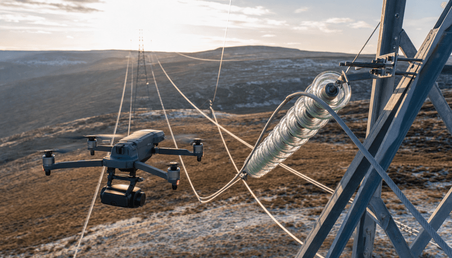
A drone crew can inspect a mile of transmission line for roughly $200 to $300 in 2026. A helicopter patrol flying the same span runs $1,200 to $1,600 a mile, and it puts a flight crew into what is statistically one of the deadliest jobs in utility aviation.
That gap is why utilities, from investor-owned giants down to rural co-ops, have moved a growing share of their inspection miles to drones. This piece walks through what aerial powerline inspection actually costs, which sensors find the faults that matter, what one real utility program produced, and where the FAA rules sit in the middle of 2026. If you run grid operations or you contract inspections out, the numbers below are the ones worth arguing over.
What drone powerline inspection costs in 2026
Start with the money, because that is what decides the budget.
A single-drone crew inspecting distribution or transmission line typically comes in around $200 to $300 per mile when a utility runs the program in-house. Hire it out and the range widens: contractors quote anywhere from $300 to $2,000 per mile, or $150 to $500 per structure, depending on terrain, the sensors involved, and how much post-processing and reporting you want. A rugged mountain span with a corona survey and a full defect report sits at the top of that band. Flat rural distribution with a straight color-camera pass sits at the bottom.
Compare that to the incumbents. A contracted helicopter patrol averages more than $4,000 a day and lands somewhere between $1,200 and $1,600 per mile once you count fuel, crew, and maintenance. A bucket truck or a climbing crew is cheaper per hour but painfully slow per structure, and it ties up linemen you would rather have doing repairs.
The savings compound at scale. Georgia Power reported roughly 60% annual cost savings after standing up its drone program, a figure documented in T&D World's writeup of the utility's rollout. Powerline work is one slice of a much broader category, so if you are scoping a mixed program across substations, towers, and rights-of-way, our overview of industrial drone services covers how these jobs get bundled, and our guide to drone inspection services breaks down the general inspection workflow.
The sensors that actually find faults
A drone is only as useful as what it carries. Three sensor types do the real work on a powerline, and anyone hiring this out should know which ones they are paying for.
Thermal. A failing connector, an overloaded conductor, or a cracked insulator runs hot before it fails. A radiometric thermal camera (the DJI Zenmuse H30T and the Matrice 4T both carry a 640 by 512 thermal imager) flags those hotspots against the ambient background, so a crew can prioritize the five structures that need attention out of five hundred that don't. Thermal is the backbone of most utility programs. Our deeper look at thermal drone inspection covers how radiometric data gets turned into a defect list.
Zoom. You inspect the top of a 140-foot transmission tower without climbing it. The Matrice 4T's tele camera reaches up to 112x hybrid zoom, which lets a pilot read a cotter pin or a corroded bolt from a safe standoff distance, well clear of the conductor and its electromagnetic field.
Corona and UV. This is the one buyers underestimate. Corona discharge, the faint ionization around a high-voltage conductor where insulation is starting to break down, is invisible to the eye and often invisible to thermal. A solar-blind ultraviolet camera tuned to the 240 to 280 nanometer band picks it up in daylight and pins the source. DJI and third-party payload makers now sell corona-detection packages for the Matrice 350 platform, and DJI documents the powerline use case on its enterprise inspection page.
One practical note on hardware near live lines: the Matrice 350 RTK holds a stable positioning fix even with the magnetic and electromagnetic interference thrown off by high-voltage conductors, which is exactly the environment where a consumer GPS drone starts drifting.
What a real utility program produced
Numbers from a live deployment beat any vendor brochure. Georgia Power's program, based out of Atlanta, is the most detailed public case study in the US.
A three-worker drone team inspected 1,400 line miles across 7,000 structure locations in eight months, averaging about 14 miles a day at roughly seven minutes of flight per structure. Over the program they captured 48,000 images for analysis.
The find rate is the part that should get an ops manager's attention. On the same infrastructure, the drone crews logged 5,174 abnormal conditions against 1,150 caught by ground crews, and 35 critical conditions against 17 found from the ground. Drones did not just cost less. They saw more, because a camera hovering at eye level with a crossarm catches defects a technician squinting up from the base will miss.
Their fleet was unremarkable, which is the point: 14 DJI M300 drones with H20T payloads, 10 DJI M30T units, and 3 Skydio X10 quadcopters with thermal. Off-the-shelf commercial hardware, not custom aircraft.
The safety case is the real driver
Cost gets the meeting scheduled. Safety gets the program approved.
Powerline patrol by helicopter is genuinely dangerous work. Wire strikes, where a helicopter flies into the very lines it came to inspect, are a leading cause of helicopter fatalities in the US. FAA accident data spanning more than a decade points to roughly 76 power line collisions a year, with about 30% of them fatal. The headlines keep coming: an MD 500 went down on a powerline job in Pennsylvania with two killed, and a separate aircraft struck lines over the Mississippi River weeks earlier.
A drone moves that risk to the ground. The pilot stands by a truck, the aircraft takes the exposure, and the worst-case outcome is a lost drone instead of a lost crew. That trade is why utility safety officers tend to champion these programs internally.
The same logic applies after a storm, when crews need to assess damaged lines fast and the terrain is often flooded or blocked. Drones scout the damage and hand restoration crews a target list without sending anyone under a compromised structure. We cover that workflow in our piece on emergency and storm-response drone work.
Where FAA rules stand in 2026
Here is the honest picture as of mid-2026, because the regulation is mid-transition and a lot of older articles have it wrong.
Routine drone inspection flies under FAA Part 107, which requires the pilot to keep the aircraft within visual line of sight. That is fine for a substation or a handful of towers. It is a real constraint for long linear inspection, where the whole value is flying miles of line from one setup. Those long flights need a beyond-visual-line-of-sight (BVLOS) authorization, and today that still means a case-by-case waiver under Part 107. A utility running inspections nationwide can end up juggling dozens of separate waivers.
That is what Part 108 is meant to fix, by turning BVLOS into a standardized, repeatable approval instead of a one-off waiver. The FAA published the Part 108 proposed rule in August 2025 and reopened the comment period into early 2026. As of this writing the final rule has not published, and industry expectations put real implementation in late 2026 or beyond. Linear infrastructure like powerlines is widely seen as the first and best fit for Part 108, so utilities are the ones watching the docket most closely. Until it lands, plan your program around visual-line-of-sight work plus specific BVLOS waivers, not around a rule that is not yet in force.
FAQ
How much does drone powerline inspection cost per mile in 2026?
An in-house drone crew runs about $200 to $300 per mile. Contracted work ranges from $300 to $2,000 per mile, or $150 to $500 per structure, depending on terrain, the sensors used, and how detailed the defect report is. Helicopter patrols, by comparison, sit around $1,200 to $1,600 per mile.
Can drones inspect high-voltage lines safely near the electromagnetic field?
Yes, and the better commercial platforms are built for it. The DJI Matrice 350 RTK holds its positioning fix despite the electromagnetic interference from high-voltage conductors, and zoom cameras let pilots inspect from a safe standoff distance instead of flying close to the line.
What's the difference between thermal and corona (UV) detection?
Thermal cameras find heat, so they catch loose connectors and overloaded conductors before failure. Corona detection uses a solar-blind ultraviolet camera to spot the ionization around a conductor where insulation is breaking down, which is invisible to both the eye and thermal. Serious utility programs use both.
Do you need a BVLOS waiver to inspect powerlines by drone?
For a substation or a short span within visual line of sight, no, standard Part 107 rules cover it. For long linear inspections flown miles from the pilot, yes, you currently need a beyond-visual-line-of-sight waiver from the FAA. Part 108 is expected to standardize that approval, but it was not yet in force as of mid-2026.
How many line miles can a drone crew cover in a day?
A small team averages around 14 miles a day, based on Georgia Power's documented program. That is comparable to a helicopter's 15 to 30 miles per day, but at a fraction of the cost and none of the flight-crew risk.
The bottom line
Drone powerline inspection is not a future bet anymore. The cost math, a few hundred dollars a mile against a few thousand for a helicopter, the sensor stack that finds more faults than a ground crew, and a safety record that keeps people out of the most dangerous seat in the operation have already made it standard practice for the utilities that run the numbers. The one piece still moving is the regulation, and Part 108 is set to make the long-range flights easier rather than harder. If you are pricing an inspection program, the providers who do this work are worth talking to before your next patrol cycle. Browse drone service providers on DroneServices, or see drone pilots working in Atlanta.